In the heart of West Ocean City is a park that provides visitors with an opportunity to experience the unique coastal plain habitat of Worcester County, MD. Herring Creek Nature Park has exemplary watersheds, open fields, and marshland; it’s like covering five different eco-settings in less than 20 acres of land.
Herring Creek Nature Park is easily accessible. It’s located just off of Route 50, Keyser Point Road, the Nature Park Lane. A large sign welcomes you to the park while a parking lot made of broken seashells reminds you that you’re at the beach. A large gazebo, old fashioned water fountains, a water pump, and a compostable bathroom facility are all on site. The park is open from dawn to dusk daily.
Tidal pond, frog pond, upland tump, pine forest, scrub-shrub forest, freshwater wetland, hill (yes, a real hill), salt pond, meadow, new forest, and wild flower field – are all included in the perimeter of the park. Interpretive signs have been placed throughout the park identifying many of these natural features so that they may be better recognized, protected, and enhanced throughout the county. Below are descriptions of some of my favorite areas in the park:
The Frog Pond: The frog pond was built to collect storm water runoff from the road and other nearby developed areas. It was designed with a shallow shelf around the perimeter and planted with native wetland vegetation. The pond serves as a habitat for amphibians and small fish that help control mosquitoes.
The Scrub-Shrub Forest: The scrub-shrub forest is covered in little bushes growing underneath looming pines. Wax-myrtle, an evergreen shrub or a small tree, often dominated low wetland areas close to tidal waters. Wax-myrtle berries sustain many birds in winter, and early settlers made candles form the berries’ fragrant wax.
Salt Pond: The water in the central salt pond is connected to Herring Creek by the stream that runs under the man-made wooden footbridge. Median high tide is about 3’ below the deck of the bridge. Storms often force water to back up in the coastal bays and creeks. During the nor’easter of January 1998, the water reached several inches higher than the bridge. The area was flooded. In the Great Storms of March 1962 and August 1933, the high tide would have been nearly 3’ over the bridge. Much of West Ocean City was completely underwater during those two storms.
Wildflower Meadow: This meadow has been planted with several varieties of wildflowers that have adapted to local soil, water, and weather conditions, making them ideal for low-maintenance areas.
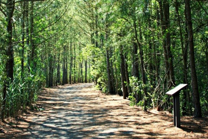
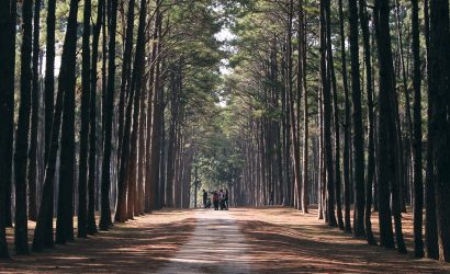
Pine Forest: This area was once a freshwater wetland forest that had been cleared for farming. Now it is being allowed to revert back to a freshwater wetland. The only plants that will survive here are those that can adapt to soils that are ponded or saturated to the surface for a large portion of the growing season. Forested wetlands filter ground water, store flood waters, and provide unique habitat for many species of wildlife. (Watch out for poison ivy, too! It’s lining the trail on either side – if it’s windy, wear pants and long sleeves!)
Much of the park was constructed in 1997 by the State of Maryland to replace wetlands lost to extreme development in this area. The Herring Creek Park project was funded by The Coastal Zone Management Act, National Oceanic & Atmospheric administration Office of Ocean & Coastal Resource Management, the U.S. Department of Commerce, and the Maryland Department of Natural Resources Coastal Zone Management Program – Program Open Space in attempt to protect local eco-systems and wildlife.
Check out the gallery below for photos taken at the Herring Creek Nature Park.

